
A New Zealand company, Augview Limited, has come up with a solution which allows engineers to “see” under-road utilities in the field, using devices such as smart phones and tablets.
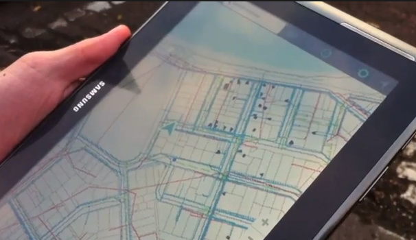
The solution combines engineering data with a GIS.
A GIS (Geographic Information System) is a spatial analysis system. GIS can provide a 21st century way of working with questions of highway design and maintenance – although the concept of spatial analysis goes back to the 19th century (wikpedia).
Roads and streets are spatial objects in (at least) 3-dimensional space. More critically, the space which roads occupy also involves other physical objects – utility networks such as electricity cables, water mains etc. One of the complexities of work in a road or street corridor is the danger of disrupting or damaging one of these utilities.
It would be very helpful to field workers if they could look at the real world around them and at the same time “see” the utility networks hidden beneath the surface of the road. Certainly it would reduce the risks of digging up the wrong utility by mistake. Augview’s solution looks to be a good step in this direction. It can show the user both a representation of the spatial location of utilities as well as technical details of the utilities such as line type, manhole invert levels and so on. Augview has a new introductory demo video on Youtube (the following link was updated on 25.10.2013):
The company is also already looking into using meta space glasses technology as the world viewing tool (see the interview with company director Mike Bundock on Youtube here).
On technical compatibility the product fact-sheet (download link) says:
Augview is OGC compliant which allows your business to leverage public data as well as providing flexibility in how to connect to corporate data. In addition to supporting the OGC services, Augview also supports Smallworld GSS native services and the Esri REST services.
